Middle Puyallup 128th Street Comprehensive Study

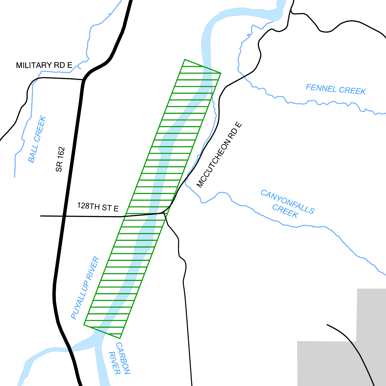
This project is a coordinated analysis to evaluate how four planned setback levee projects in close proximity alleviate flood risk and impacts along both the right and left banks of the Puyallup River near the 128th East Street bridge crossing including as outlined below. The study will determine the number and timing of each setback levee based on habitat gain, amount of added flood storage, project costs, amount of property needed, community impact, construction timing and how each project affects one another. The potential projects are listed below.
Project website: https://piercecountywa.gov/6867/128th-Street-Comprehensive-Setback-Levee
Northwest Quadrant – 116th Street Reconnection/Setback – The 116th Street Reconnection & Setback Project includes removal of existing levees and construction of new levees farther back from the Puyallup River. Approximately 4,933 linear feet of existing levee and revetments located along the left (west) bank of the Puyallup River between Puyallup RM 15.7 and 16.7 would be removed and a new armored levee of approximately 6,910 linear feet would be set back from the Puyallup River to the west, encompassing an area of approximately 104 acres. The project would reconnect the Puyallup River with riparian vegetation, wetlands and ponds.
Northeast Quadrant – Canyon Falls Creek – The proposed Canyon Falls Creek Project involves the removal of existing levees and construction of new levees farther back from the Puyallup River. Approximately 3,820 linear feet of existing levee and revetments located along the right (east) bank of the Puyallup River between Puyallup RM 15.9 and 16.7 would be removed and a new armored levee of approximately 3,899 linear feet would be set back from the Puyallup River to the east, encompassing an area of approximately 46.3 acres. The project would reconnect the Puyallup River with riparian woodlands, a major tributary (Canyon Falls Creek), wetlands, and remnant side-channel habitat.
Southwest and Southeast Quadrants – McCutcheon Road and 128th Street East –The proposed solution is for the construction of setback levees on both the left and right bank of the Puyallup (setbacks #12 and #13 from the Levee Setback Feasibility Study). The right bank levee (SE Quadrant) would follow the alignment of McCutcheon Road then follow the topography and tie back into the river at the confluence of the Puyallup and Carbon Rivers. The left bank levee (SW Quadrant) would follow the contour of the historic channel migration and tie back into the Puyallup just prior to the 128th Street Bridge crossing. The Southwest quadrant has been identified as a mitigation project in the draft Pierce County Flood Risk Reduction Maintenance and Operations Habitat Conservation Plan and is therefore not a FFTF project.
